The most beautiful summit hikes in Davos
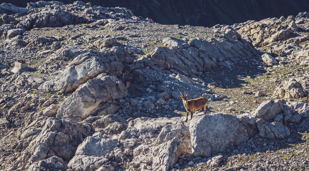
We proudly present: the most beautiful mountain top tours in Davos Klosters. Do you want to cross the Austrian border or climb Schiahorn (2709 m) and see the local ibexes? Solely on foot or in combination with the cable cars: There is a tour for every preference. Stunning scenic views included!


Jakobshorn
Impressive ridge hike to Jatzhorn
A hike up Jatzhorn is definitely worthwhile. At 2682 meters above sea level, you will enjoy beautiful scenic views. Tinzenhorn, Schwarzhorn and Hochducan are just a few of the many peaks you can spot from there. The best part: Jatzhorn is almost fully accessible by cable car!
In half an hour onto the Jatzhorn summit
From the Jakobshorn mountain station, follow the narrow trail upwards, and you will reach the summit in half an hour. The trail runs along the ridge most of the time, so focus and surefootedness are important. Don't forget to take short breaks to enjoy the view of Lake Davos and the surrounding mountains. Jatzhorn is the highest point of the hike. Have you already signed the summit book?
Via Rossboden into Sertig Valley
You can complete the hike with a descent into the beautiful Sertig Valley. Our tip: For a break, we recommend a stop at the Bäbiwald barbecue site, which lies in a fantastic location next to a pine forest.
Altitude summit: 2682 m a.s.l.
Start point: Jakobshorn mountain station
Destination: Sertig Dörfli
Duration: 4 h
Difficulty: medium


Parsenn Davos
Hike up to the Schiahorn summit
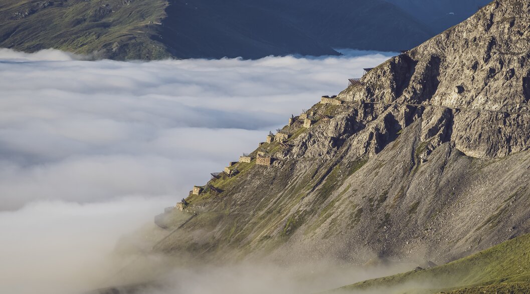
A characteristic feature of the Schiahorn is the noticeable avalanche barrier, which indicates the steepness of this peak. An impressive mountain and a great hike. This summit climb can be combined with a hike along the beautiful panorama trail connecting Gotschna and Parsenn. You might even see an ibex!
Start at the Höhenweg middle station
For the hike, take the Parsenn cable car to the Höhenweg middle station. Briefly climb up to Höhenweg and follow the signs in the direction of Strelapass. On this trail, you will walk around Klein Schiahorn, the little sister of the summit you are going to climb. An area with many beautiful photo spots! From Strelapass, you start the steep climb to Gross Schiahorn. Soon you’ll have made it! As a reward for your efforts, one of the most beautiful views of Landwasser Valley awaits!
Refreshment stops along the way
The return route takes you along the same trail back to Höhenweg. At Höhenweg Restaurant, you can treat yourself to a delicious pizza after the hike. Alternatively, you can opt for the descent via Schatzalp. A stop at Strelapass Mountain Restaurant is well worthwhile when you’re there!
Our tip: The hike can also be experienced in a group with a hiking guide. Find out more about the guided summit hike on Schiahorn and join us!
Altitude summit: 2709 m a.s.l.
Start & end point: Höhenweg middle station
Duration: 3 h
Difficulty: medium


Parsenn Gotschna
Breathtaking mountain top tour to Grüenhorn
From the Gotschnagrat mountain station on Parsenn Gotschna, you can't miss Grüenhorn – green vegetation on one side, grey rock on the other. The hike will take your breath away. The views of Wolfgangspass and Lake Davos or the Prättigau are simply amazing. The tour is challenging – but hard to beat in terms of scenic beauty.
Steep start to the top of Grüenhorn
From the Gotschnagrat mountain station, the trail leads in regular zigzags up to the summit of Grüenhorn (2501 m a.s.l.). Important: You should be sure-footed and have a head for heights for this hike. Feel free to use the beautiful views along the way as an excuse for short breaks. After about 40 minutes, you will arrive at the top. The actual summit can be reached via a short hike along a ridge. There is room for only one person there. Enjoy the view into the distance! From here, you can even see the mountains of Austria. The unique landmark rock next to you is called Casannanadel. Are you already familiar with the legend of this rock? You can read the story at the summit by scanning a QR Code.
Along the ridge to the rest areas
The trail now continues along the south face of the Casanna. Some parts are secured with ropes. From Parsennfurgga, you’ll descend to the Totalpsee valley station. Refreshments are available at Mungga Hütte or on the sundeck of Parsennhütte. Take the Panorama Trail back to Gotschnagrat and then the cable car back to Klosters.
Alternative route to Davos: The hike can be continued from Parsennfurgga in the direction of Weissfluhjoch. From there, the funicular takes you to Davos village.
Altitude summit: 2501 m a.s.l.
Start & end point: Goschnagrat mountain station
Duration: 3 - 4 h
Difficulty: challenging


Rinerhorn
Sporty tour to the Rinerhorn summit
On the way up to the Rinerhorn summit, you can enjoy wonderful scenic views of the Landwasser and Sertig valleys. The loop starts at Jatzmeder and leads to the Rinerhorn summit and via Marchhüreli back to Jatzmeder. The tour is also suitable for sporty families looking for an unforgettable experience.
Ascent towards the sky
For your first ascent, take the comfortable cable car to the Rinerhorn mountain station. If you prefer to take it easy, take the wide trail in the direction of Äbirügg. Alternatively, you can also take the steeper trail towards Hubel. The destination is the same for both trails: the beautiful Hubelhütte Restaurant with Tinzenhorn right within reach. Enjoy a first break on the sundeck. With the summit in view, the trail continues up to the Rinerhorn summit. Have you heard a marmot whistle yet? Once you reach the top, magnificent views are waiting for you. Don't forget to place your stone on the cairns!
Descent to Jatzmeder Restaurant
In the second part, the trail continues to climb towards Marchhüreli. You can bypass this small peak and reach the mountain station of the Nüllisch ski lift via a scree field. Continue down through the beautiful little valley towards the mountain station. At Jatzmeder Restaurant, you can relax on the sundeck. Have your little ones discovered the playground yet?
Our tip: If you are a sporty family, you should have this hike on your holiday program.
Altitude summit: 2560 m a.s.l.
Start & end point: Rinerhorn mountain station
Duration: 2—2.5 hours
Difficulty: medium


Madrisa
Scenic day hike onto Rätschahorn
Alpine meadows, mountain streams, impressive peaks and inviting mountain restaurants – the unforgettable hiking tour onto Rätschahorn combines all that and more. The challenging summit in the Prättigau region rewards you with a wonderful view all the way to Austria. Tip: If you take the cable car up to Madrisa, the first part of the ascent will be comfortable and you can save your strength for later.
Via Rätschajoch to the summit of Rätschahorn
Take the Madrisa cable car from Klosters to Madrisa and follow the Prättigauer Höhenweg trail across beautiful alpine meadows to Obersäss. The hiking trail leads you into the Chüecalanda valley before the ascent to Rätschejoch starts. You’ll quickly gain altitude on a zigzag path and reach your first destination at 2600 metres above sea level. Time to take some deep breaths. From Rätschejoch, the hike to the summit takes another half an hour –but the effort will be duly rewarded with a fantastic view. Characteristic of Rätschahorn are the white Gafier rocks, which shine particularly brightly in the sunlight.
Via Gafiatal valley to the Walser village of St. Antönien
From the Joch, the trail leads you down into the idyllic Gafiatal valley. You’ll follow the babbling brook and find yourself at the Edelweiss inn, which invites you to take a break. The major part of the day's hike is done. Now you’ll descend to the village of Rüti and continue on the road to St. Antönien. For the return journey, the bus takes you to Küblis, and the train of the Rhaetian Railway (RhB) continues to Klosters or Davos.
Impressive: The route of the “Madrisa Trail” sports event leads over the impressive summit.
Altitude summit: 2703 m a.s.l.
Start point: Madrisa mountain station
End point: St. Antönien
Duration: 5.45 hours
Difficulty: challenging


Parsenn Davos
Enjoying the view from Chörbschhorn to Arosa
The hiking trail to Chörbschhorn follows the mountain range which connects the municipalities of Davos and Arosa. Beautiful views of the two valleys and impressive peaks will surprise you constantly. For a comfortable ascent, you can take the Parsenn funicular.
Past the mountain lake via Latschüelfurgga to the summit
The hike starts at Weissfluhjoch, where you’ll cross some gravel fields before you’ll reach the epic rock path. The rock formations are reminiscent of the Dolomites. You’ll get toStrelapass, where friendly hospitality awaits you at the mountain inn. As you continue along the trail, you will pass the small Lake Strelasee. A beautiful mountain lake where you can cool off on hot summer days. During a short break, you’ll have a wonderful view of Schiahorn and the Weissfluh peak. The trail now leads along the mountain ridge to Latschüelfurgga. This mountain pass is one of the most famous crossings between Davos and Arosa. After the Furgga, the trail climbs slightly. Shortly before Chörbschhorn, the path becomes very steep, but don’t worry: You’ll be there soon. After about two hours of hiking in a dreamlike landscape, you will reach the summit and enjoy stunning scenic views.
Descent via Chröbschhorn hut to Stafelalp and on to Davos Glaris
The hut with the same name is located just below "Chörbschhora". And that’s where the descent into the valley in the direction of Davos Frauenkirch begins. After about half of the way, you will pass "Berghaus Stafelalp", where food and drink are served year-round. After about 2.5 hours, you will reach Frauenkirch from where the bus and train take you back to Davos.
If you would like to go easy on your knees, you’ll also have the option of returning to Strelapass. From there, the well-known panorama trail leads you to the Höhenweg middle station. After walking just a few metres downhill, the Parsenn funicular takes you comfortably down into the valley.
Option for ambitious hikers: The ascent to the summit can be combined with a hike to Arosa. To do this, choose the Schwifurgga as the crossing point to reach the valley of the neighbouring municipality.
Altitude summit: 2575 m a.s.l.
Start point: Weissfluhjoch Parsenn mountain station
End point: Davos Frauenkirch
Duration: 2.5 hours to the summit | 5 hours with descent
Difficulty: medium


How many summits have you already climbed? The suggested mountain top tours are wonderful experiences. You can find other beautiful hikes in the Davos Klosters Mountains described on this page. Now all you need to do is pack your rucksack and start hiking. We wish you lots of fun in the Davos Klosters Mountains!
Your Davos Klosters Mountains Team